Tuesday 25 June 2013

Saga of driving the Dempster


June 24, Dawson City again, 

We made it!  Drove the Dempster all the way to Inuvik and back and lived to tell the tale.  There were some challenges for sure, but all in all, the rewards were worth the effort.  Inuvik is a great place to visit – a world away from our southern experience of Canada.  Although its single tenuous connection by road to the rest of us is south to Dawson City and Whitehorse, its focus is clearly north.  The delta, the sea, the rest of the arctic is very much the direction they face.   

It’s the first northern town I’ve seen with the curiously visible infrastructure called ‘utilidors’.  Snaking along behind every row of homes or businesses is a continuous elevated boxlike train containing water and sewer pipes.  Every building has a branch that heads off across the back yard to connect to the town services.  There’s no running through the back lanes here unless you can leap tall utilidors in a single bound.  (Apparently they used to be flat roofed wooden structures which did make running from house to house more fun in the olden days!)  The reason of course is the underlying permafrost which prevents virtually any below ground development.  All buildings sit on stilts with a three to four foot air space to prevent thawing and the resultant sinking.  It does mean you can build a great root cellar.

For a town of 3500 people, it’s surprisingly well serviced.  There’s a beautiful library, new schools, college, fitness centre, hockey and curling rinks, ski trails, and a wonderful Hawaiian themed indoor pool.  The liquor store is massive, which unfortunately reflects one of the problems common to much of the north.  The grocery stores are well supplied but horrifyingly expensive.  We splurged on a bag of fresh cherries for $16 and stocked up on fresh milk at $3.59 a litre.  (Almost as bad was the diesel at $1.89 per litre.)  But we did find bargain priced reindeer steaks by calling a number we were given, finding the guy’s home, and digging through six freezers in his ramshackle yard.  (Twelve hundred reindeer, a cousin of the native caribou, were herded here from Alaska many years ago and now about 4000 roam freely, managed locally for meat.) 

Our favourite stop in Inuvik was the community greenhouse.  Converted from an old ice rink, it now houses dozens of raised beds, already bursting with edible greens, herbs, rhubarb, flowers and budding tomatoes, peppers, eggplants and squash.  It’s been a huge contribution to food security here, where 57 days of continuous sun provides only the briefest of growing seasons between the colder months.   

The seasons here are either endless (winter, I imagine), brief (summer and fall), or nonexistent (spring).  When we drove up the Dempster 2 weeks ago the willows and aspens were barely budding, there was ice on many lakes and streams, and it was frosty at night.  Now the shrubs and few deciduous trees are fully leafed out, snow only clings to the north facing slopes, and it’s 30 degrees today.  And mosquito season is in full swing!  The locals say it’s a bad year, but I think Manitoba still has the lead in Canadian insect culture.  We had to cover up along some of the rivers when we were fishing or hiking, but above the tree line or in any breeze we weren’t troubled.   

Fishing – I’d have to say poor, although Norbert did catch a nice big arctic grayling for the pan, and several smaller ones.  Hiking – spectacular, especially in Tombstone Territorial Park, just 60 km north of Dawson.  I said we’d had some challenges, and one of them was a steep, slippery, rooty, rocky, sweaty climb up through heavy brush to a lookout.  Once there, panting and exhausted, I was just beginning to appreciate the effort when a humungous thunderstorm swept in and sent us hurtling down the now more slippery path to shelter as the lightning cracked around us.  Great hike!  Luckily it was balanced by a stupendous hike above the tree line next day – no bears, no bugs, no storms, and endless views.  I’m afraid this is where my inadequacy as a photographer is really evident – the magnificence of these mountain vistas is just impossible to reproduce.  Norbert is a much better photographer, but he keeps all his photos on his camera so we won’t have the benefit of his gift til much later.   

And I mustn’t forget the difficulties of driving 743 km of rather dodgy gravel.  The Dempster shredded two of our tires on the return trip.  The first, a sudden flat, occurred 120 km from nowhere, and we managed to fix it with the help of some other travelers who stopped to assist.  (We had practiced this maneuver just in case – the road does have a reputation for eating tires.)  The second we noticed while we were working on number one.  One of our front tires was bulging ominously on one side, and we’d just used our only spare.  We limped in to Eagle Plains the next day at 20 km per hour, hobbling along on our egg shaped tire which had lost some of its steel belting.  I had visions of spending several nights in this dusty gas station waiting for new tires from Whitehorse, but unbelievably, there were two tires for us in stock, they were installed while we had lunch, and we were on our way again!  Great outcome! 

Today we are back in Dawson City, luxuriating in clean showers, laundry, and the usual housekeeping chores.  We still have plenty of touristy things to see here, and are waiting for another two tire replacements tomorrow, just in case!   We’ll leave here heading west, across the Top of the World Highway into Alaska, and then on to Fairbanks, Denali National Park, and Anchorage.  We’ll keep you posted on the next stage of the saga!   


Posted June 25 at Gold Rush Campground, Dawson City

PS - Yet another tire change yesterday!  Becoming experts by now, but it's still a difficult job!  June 26
The RC church in Inuvik is an igloo!


Utilidors running through the yards behind every building.  I think the bright colours are to help in the long winters! Not much opportunity for outdoor gardening here. 


Inside the community greenhouse.  Everyone has decorated their plot and each is a work of art.


The tiny village of Tsiigehtchik at the confluence of the Mackenzie and Arctic Red River.  Pop. 159, all First Nations except one Jamaican.  Weird. 


The Tsiiigehtchik graveyard - beautiful and heartwrenching.  These are tiny babies graves (there are many), and there are many young people as well.  Still in use, and quite a few recent graves of local elders.


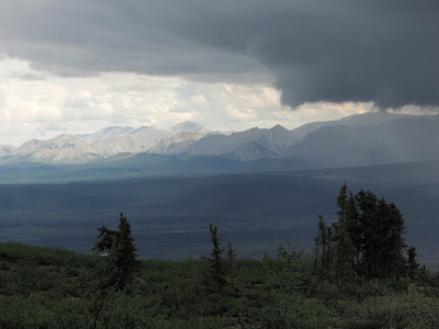
Storm over the Dempster.  The weather is stark and changes with no notice.  Dress in layers really means something here - it goes from 5 to 30 in a few hours, then back again as the wind whips up. 


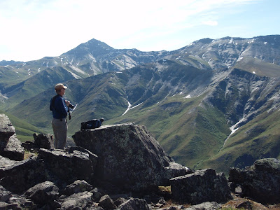
Hiking in Tombstone Park.  The rivers often retain their ice higher up, making mini glaciers all year.  Saw a gyrfalcon from here, gliding just below us.  The hillside is covered in low bush cranberries - but not ripe yet!


The peak on same hike - 360 degree views, amazing scenery.  All this only two hours from the campsite!

Tuesday 18 June 2013

Ivaavik National Park Trip


June 18 Trip to Ivaavik with Parks Canada
Flying over the northern coastline gives you an entirely unexpected perspective on Canada’s vast maritime border.  The Beaufort Sea stretches across the western arctic, longer than our two other coasts, and infinitely wilder and more isolated.  The vast Mackenzie delta reaches out to the icy sea, spreading west from Inuvik for 60 km.  From the air, it’s a maze of watery reaches separated by the occasional band of tiny spruce trees or marshy tundra, impossibly contorted and confusing.  But here and there are open boats shooting along towards fishing camps on isolated hummocks, pairs of tundra swans camped in private lagoons, and bald eagles scouting char and ducks.  Towards the west as the tundra rises into the most northerly reach of the Rocky Mountains, clusters of migrating caribou range across the rolling dry hills, heading west and north towards the arctic coast where summer grazing is rich and wind will disperse the ubiquitous bugs.  Then the rocky peaks take over, sharply V-shaped valleys lined with rubble strewn rapids.  No glaciers ever smoothed these rocks, so fragile shale crumbles down the slopes, eroding around the towering volcanic rocks that remain standing on the mountain tops.  These tors protrude like ugly teeth in long ridges down the spines of the gravelly slopes.  Our plane followed a tumbling river to a wide flat valley in the mountains, and there we landed at our camp in Ivaavik National Park, just below the northern coast, in the north west corner of Canada.  

Our camp was far more civilized than I had anticipated.  Parks Canada maintains a summer facility for research and teaching here, so there is a permanent cook shack, outhouse, workshop and tent encampment set up.  Equipped for 30, we were lucky to have only our group of 12 at the site, so we had the run of the posh equipment – spotting scope, Coleman stoves, screen tents, and picnic tables!  We were lucky to have some family members of our 2 parks guides along too, all of whom gave us a fantastic view of life in the north.  The whole paradigm of hunting caribou, Beluga whales, snow geese, and grizzly bears is pretty different from my life in Kitsilano!  It’s hard to conceive of roast swan for Christmas dinner! 

We spent 4 days at Sheep Creek Camp, fishing (unsuccessfully – the rivers were very high), hiking, singing, socializing and wildlife viewing.   The weather was less than fabulous, in fact downright hostile at times, so the photography is quite disappointing, but otherwise the trip was fabulous.  We hiked high into the rugged mountains, following ridges past the massive tors, and up steep scrambling pitches.  The camp sits high in the scrubby taiga forest, so most of our hiking was above the tree line.  It made spotting the wildlife easier, and meant approaching grizzly bears couldn’t surprise us.  In fact we only spotted one bear, across the river, but he was big and scary enough for me!  We did see plenty of caribou – the males are following the earlier migration of the females with calves, so they are lollygagging through the mountains towards the coast.  Sheep are plentiful – an all white version of our Rocky Mountain bighorn sheep, and moose left plenty of sign, but no visible appearances.  Our camp was occupied by arctic ground squirrels, or sik-sik, as they are known locally for their chirpy calls.  Curious and friendly, they were everywhere, including one little guy we dubbed Mr. Shitty Pants after he fell into the outhouse and had to be rescued!  Golden eagles, terns, ptarmigan, swallows, and ravens entertained us daily. 

The endless daylight was even more noticeable living in a tent.  Even with an eyeshade I would wake to sunlight piercing our window at 3am.  Some of our group, not yet exhausted by 12 km day hikes, set off at 10pm to bag yet another peak.  Their photos of midnight mountaintop panoramas were stunning.  I wished I had the stamina to join them but 3 days of challenging hill climbing was enough for me.  I could happily have stayed on, especially as the sun came out as our plane arrived to take us home, and 4 days seemed all too short to see enough of the animals and geology in the park.  If the opportunity to return occurs, camping or river rafting on the Firth, I’ll be back.  It’s a magnificent landscape and an altogether stunning holiday. 

Today we’re back in the camper in Inuvik for a few days.  There’s unpacking and laundry to do before we reprovision and head back down south.  For now though, the sun is out, the sky is blue, and we’re enjoying life.  Hope you are too!  
 
Posted at Inuvik Public Library.

 
THis is Sheep Creek, with our little camp on the plain below us.  Yes, still ice!
 
At the top!  Rugged ground and somewhat challenging hiking, but we had fun.
 
The wildflowers were beautiful.  Up here their colours are very intense, supposedly to attract bees and butterflies.
 
Sheep Creek and our tent site from the cook shack deck.
 
Norbert is pointing to the peak he just climbed!  No kidding!
 
Our plane arriving on day 4, sunny at last.  It's a twin otter, with huge tundra tires.  And you should see the runway!
 
Mackenzie delta from the plane.  The ice is still around, and the water is really  high and muddy.

Thursday 13 June 2013

Up the Dempster


June 11 – Rock River Campground, km 445 of the Dempster Highway

‘Oh man, not again!’  cried Norbert as a great gout of wet mud hit the windscreen.  We were half way up the Dempster Highway on day 2 of our trip to Inuvik and we were deep in mud.  Day one had been a fabulous trip through boreal forest and alpine tundra under dappled skies, but we had woken this morning to rain which quickly turned much of the gravel road to legendary gumbo.  For 80 km south of Eagle Plains, the half way stop, the road was pitted and rough, and often a foot deep in muck.  Tracks of previous vehicles left deep soggy ruts, and the odd truck who passed us sent up great plumes of spray that covered our truck.  Just driving through it caused waves of wet mud clods to cascade up over the hood onto the windscreen.  The wipers could only barely keep the centre clear, and it felt like being enclosed in a blackened secret vehicle. 

At Eagle Plains the rain had stopped and with improved gravel surfacing it looked more promising ahead.  We filled up with diesel, coffee, and the weather report, and Norbert cleaned all the windows, the rear view mirrors, and the headlights.  (This is the man who carries a spray bottle of Windex and a roll of paper towels in his door pocket – and uses them every day!)  Not two minutes later, we hit the next mud puddle, and were back to square one!  Some days you just can’t win. 

We soldiered on, reluctant to complain given what early travelers like the Klondikers endured in this difficult country.  Besides, we had spotted a narrow single track weaving in and out of the ruts and we were arguing about whether any cyclist in his right mind would be out here today.  We had already passed 3 hardy Quebecois on motorbikes who were planning to get to Inuvik today, but had turned back somewhere in the muddy section.  The narrow track slithered across the road, disappearing for a while in the mire, then reappearing ahead of us.  We searched each pullout for a wet dirty biker, thinking we might need to offer him a ride, and wondering how we would fit him in.  Then suddenly he appeared in front of us, leaning on a small dirty car, and drinking coffee with the driver.  We had to stop to find out the story, and sure enough, another character in this land of eccentrics.  They were a couple from Ontario, she driving the support vehicle, equipped with tent on roof, solar panels, microwave, and solar shower, he cycling the Dempster despite the weather.  Crazy people!

It’s a wild and lonely place, traversed by very few vehicles.  Yesterday we passed only 10 others coming south and no one passed us going north.  We turned on Sheila, our Aussie voiced GPS, to see if for once she would be speechless, but alas, there we were on Yukon Hwy 5.  At least Sheila didn’t ask if we’d prefer to switch to pedestrian mode, which she had offered once on a seriously slow back road in New Mexico.

Tonight we are camped north of the Arctic Circle for the first time.  It’s cool, but dry and we made a toasty fire for comfort after our arduous day.  We’re always cozy in our little camper, and despite the outside mud, we’re still clean and civilized inside.  Can’t see out the back windows, but I’m sure Norbert will be working on that shortly!  More on the Dempster tomorrow – another 300 km to go.

June 13, Happy Valley Campground, Inuvik

We made it!  And yes, it is a big deal - considerably less arduous on day 3 as the rain had stopped, and the road surface improved significantly, but still quite exciting.  We crossed into the North West Territories at the top of the final pass, amidst melting snow from the previous day’s storm, and then took two ferries to cross the Peel and the MacKenzie Rivers.  The ferries are only summer crossings of course, and there is a space of a month between the winter ice road when the ice breaks up that the northern communities are cut off by road.  The Peel ferry just began operating 5 days ago, so people were happy to see it running.  Most of the lakes are still ice covered, and apparently so is the mouth of the MacKenzie, so Tuktoyaktuk is still only accessible by plane.  We are hoping to get there next week.

In the meantime, we have a trip into Ivaavik National Park planned starting tomorrow.  We are flying in for a 4 day hiking trip with Parks Canada.  It’s going to be a fabulous experience, with the potential for lots of wildlife viewing, photography, and natural history.  Lots of packing still to do – we need to jam all our gear into 2 packs, and are limited to 30 lbs. each, so this may be a very basic trip.  Wish us well, and we’ll be back on Monday to tell you all about it.    
Posted June 13, Inuvik Public Library  
The start of the epic.  Looks quite ok doesn't it?  Nothing to scare you.
 
Fabulous scenery - tundra and frozen lakes, snowy mountains and gorgeous skies. 
But...  then the mud began!
 
But here we are, battle scarred but intact, at the Arctic Circle.

Day 3, our first view of the mighty Mackenzie River.  It's impressive.
Approaching the ferry ramp.  This is no BC Ferry!  The ramp is constantly under construction by a pair of front-end loaders who simply move the gravel down the bank as the river drops.  Very efficient!


Sunday 9 June 2013

Dawson City and beyond


June 9 – Goldrush Campground, Dawson City

I’m sitting in the sun, beer in hand, eating Norbert’s fresh guacamole, trying to channel my inner Robert Service to entertain you.  Dawson City is like that – a rollicking, free thinking, messy sort of town, full of characters and drunks and crazy juxtapositions.  In 1897, 30,000 people lived here, mostly in tents strung along mud streets.  There were 30 bars, a silk dress shop, brothels, banks, riverboats and dog sleds.  Today there are only 1800 hardy souls, a paved highway to civilization, no riverboats, but still plenty of dogs.  The dirt streets are lined with glorious restored heritage buildings and broken down rusty tin huts.  There are still grizzled miners, but also dreadlocked hippies, costumed interpreters, uber-fit bikers, German tourists and skateboarding punks.  I doubt that Dawson still consumes more champagne than St. Petersburg, but it might give Dusseldorf a good run for the world beer title.   

Dawson is a wonderful town to be a tourist.  Parks Canada has a beautiful office in the steamship company headquarters building, and has restored about half the heritage buildings in town.  We really enjoyed the guided walking tour of the town, giving us an inside glimpse of the original post office, bank, theatre, assayer’s office, and a turn of the century bar.  Sadly, the brothel has fallen into private hands.  Robert Service is revered here, and his cabin is open to tours that of course include a recitation of BOTH The Cremation of Sam McGee and Mother, Please Don’t Stab Father with the Breadknife!  (If you haven’t heard the latter, please ask for my rendition next time I’m around!)  The Palace Grand Theatre has been recreated and we joined in a great debate to choose the most famous Klondiker – a choice between three local characters who lied, cajoled and pleaded their way into our hearts!  Hilarious! 

We’ve taken some time to catch up on housekeeping details – laundry, water fill, sani dump, groceries – which we can’t do in the more primitive campsites that we tend to frequent.  It’s also fun to be in town where we can walk to a restaurant and connect to the electronic world for a change.   You may notice that I’ve managed to add better photos with captions this time – a triumph of Microsoft over Apple I’m afraid.   

Tomorrow we head up the Dempster Highway to Inuvik.  It just opened yesterday after a month waiting for the river to go down so they could put the 2 ferries in the water over the Peel and the Mackenzie Rivers.  Prior to spring breakup (which was very late this year, on May 16) you can drive across on the ice roads. Finished in 1978, it’s 743 km of gravel, crossing the Continental Divide 3 times, two mountain ranges, the Arctic Circle, and the Yukon-NWT border.  We’ll spend 3 days along the way, fishing, hiking, and hopefully seeing lots of wildlife.  The most wildlife we’ve seen so far has been at the Sourdough Bar here in Dawson.  From the day we cross the Arctic Circle at km 405 until we make our way back down, the sun won’t go below the horizon.  (And I’m having trouble sleeping now!  Here in Dawson the sun sets at 11:40pm and rises about 4am.  It’s never even dusk, just sort of less bright at 2am.  You can see how midnight golf seems more feasible here.)  From Inuvik we’re doing a fly-in hike to Ivaavik National Park on the NW corner of the Yukon with Parks Canada.  We’ll be out in the park June 14-17, but will likely be able to check in wherever we camp in Inuvik.  I’ll have plenty of photos for next time!      

Keno, a goldrush town on the Silver Trail, half way to Dawson, at the end of a 100 km of gravel, high in the mountains. 
   

Front Street in Dawson, 10pm, with the Moosehide Slide in the background.  It was an ancient naturally occurring landslide visible for several miles down the river, signalling arrival in Dawson.   

We didn't attend the Commissioner's Ball unfortunately!  If only we'd known to bring fancy dress!
We did attend the Commissioner's Tea, although rather poorly attired for the gravity of the occasion.


Robert Service's cabin, across the street from Pierre Berton's home and just down from Jack London's cabin.  Of course, it has to be known as Writer's Block.


Just as it looked in 1897, but the beer costs more.


High water in the Yukon River.  This is the town dock, and this is why we've been waiting for the rivers to fall so the ferries are operating.  The ferry across the Yukon here in Dawson has been in the river for 2 weeks now (seen in the background), but the banks are deep with mud. 

Tuesday 4 June 2013

Yukon Thoughts

Monday June 3, Snafu Lake, Yukon

We've entered the Yukon (or Yukon if you prefer, more on that later) and it's clear we're not in Kansas any more.  Coming from a land built on industry, fishing, forestry and hydro power, you enter a much earlier era here, without factories, mills, dams, or development.  The boreal forest, dense and untouched, stretches endlessly, unmarked by man.  No hydro towers, no power lines, no clear cuts, no blemishes.  Canada's last great unfettered rivers are here.  

It's all about rivers in the north. The first white men came here in 1763 in search of more furs, traveling along the first nation's river routes.  North West Company and Hudson Bay Company posts were at the confluence of important rivers - the Frances, the Pelly, the Porcupine.  When gold was discovered in 1896, tens of thousands of would-be miners arrived here on the coast, hauled their kit overland, built boats and with various degrees of success sailed down the rivers.  The Stikine, the Teslin, the Tagish all fed into the Yukon, and 1600 km downstream to Dawson.  And again in 1943, spurred by Japanese invasion of the Aleutian Islands, the Americans arrived in droves to build a supply highway and oil pipelines to their airfields in Fairbanks.  They built the Alaska Highway in 11 months, following the same river routes through the coast mountains.  They all left their mark, these newcomers, in crumbling log cabins and gravel piles, and always by the river.

We've travelled another 400 km up the Alaska highway, from Watson Lake along beautiful Teslin Lake, to the road to Atlin.  Long stretches of forest and lakes are only rarely punctuated by either derelict or soon to become derelict gas stations and resorts.  Only those with enough imagination to create a cinnamon bun niche or a wildlife museum survive.  These stops become multi-purpose, serving gas, diesel, food, phone, showers, and occasionally cabins, campground, tire repair and rarely mechanics, all powered by diesel generator on site.  No wonder the showers cost $5!  

Today we took a detour to see Atlin, 100 km down a mostly gravel road, back in BC.  Surrounded by glacial mountains, and turquoise lake, it's clearly entitled to it's moniker the Shangri-la of the North.  Stunning views, delightful history, quirky architecture, eccentric people - I thought it was more Nelson meets SaltSpring Island.  Would love to come back for the arts and music festival in July!  

Increasing amounts of wildlife in the past couple days too - bears, bison, mountain goats, one rapidly retreating caribou, one red fox, and plenty of grouse.  We were hoping to veer off to the north along Hwy 4, the Campbell Highway, but it sounded too wet and muddy.  Three highways are currently closed due to flooding, including the Dempster which we need to drive to Inuvik next week.  We've stayed on the Alaska Highway instead, which hasn't in fact been a hardship, but I keep imagining the great herds of caribou and moose that we might have seen along the Campbell.  Perhaps if I picture the grizzly bears strolling through the campsites we've missed I'll feel a little better!

Tonight we are alone again, by a deep blue lake, in another perfect Yukon campsite.  Nice sites, free firewood (which Norbert likes), and clean and cute outhouses (which please me).  (The outhouses in the Yukon are so sweet - painted dark green, they all have a large vestibule surrounded in white painted lattice.  Sort of 'the outhouse your grannie might build'.)  If the wind dies down, we might even have fish!  Who could ask for more?

Posted in Whitehorse June 4
The dock in Atlin BC, looking across Atlin Lake to the west.

The road to Atlin - another 60 km of gravel, but sensational views.
The Canol road, built by the US military in 1940's to develop a pipeline connecting the oil wells in Norman Wells NWT to Whitehorse in order to supply the Alaska Highway, is littered with abandoned vehicles.  The pipeline cost $134million and was only used for 2 years.  The original Boondoggle! 
Gorgeous site on Atlin Lake, but too windy to stay.
Downtown Atlin, pop. 350.  It's absolutely stunning scenery, but in the way back of beyond. 

Saturday 1 June 2013

Weather and wildlife

Friday May 31, Liard Hot Springs PP

It seems we've fallen into our relaxing travel rhythm now, after a week on the road.  Each day seems timeless, meals occur when we're hungry, and there's no pressure to get anywhere quickly.  The only problem is sleep, and I'm beginning to see what happens to people in the north each summer.  Even at this latitude,  at the end of May, dusk is about 10:30 at night and dawn is somewhere shortly after that.  (I can't be too exact, but I'm sure it was light the other night at 4 when I got up to pee!)  It's not really dark enough in the camper to feel like night, and even wearing an eyeshade, I'm finding it hard to sleep.  I can only imagine how energizing all this light must be if you've just emerged from a Yukon winter of darkness.  Apparently lots of northern folk simply stay awake all summer!  Hmmm, I see madness in that direction!

Our weather has been less than hospitable so far - massive thunderstorms, hail, rain, wind, ...  but not many mosquitoes so far, though they may be increasing exponentially each day now.  Yesterday was the first really fine day we've seen, and we used the sunshine to hike a very steep peak next to Muncho Lake, then relax in our campsite and fish.  Apparently the last of the ice just disappeared from the lake this week, and the fish are just awakening from their long winter nap too.  But Norbert brought back a nice lake trout for dinner, so no complaints. 

Our wildlife viewing has been pretty dim in the grey weather, and despite plenty of warning signs on the highway through Muncho Lake Park we didn't see a single Stone Sheep (a variant of big horn sheep).  Today things are looking up - bunnies in the  campsite, then a huge moose by the highway, a magnificent golden eagle (I've never seen one before), followed by several large herds of wood bison just before Liard.  Let's hope this is a sign of things to come.

Liard Hot Springs has been on our must see list for years, and it definitely exceeds expectations.   A little oasis of warmer microclimate surrounds the steaming mineral pools, attracting birds, moose, and shivering northerners.  The pools are undeveloped, except for cedar shelters and benches, and water pours in at scalding temperature, mixing with a cooler streambed.  It's blissful to loll in the heat, listening to songbirds, surrounded by wildflowers and ferns.  We did find an unexpected downside though - it also attracts the world's fattest people!  The campsite is filled with 50 foot motorhomes from Florida and Minnesota, and the pools are occupied by 300 pound behemoths floating their blubbery way downstream.  Ugh!  

We'll take the boardwalk back to the pools tonight, and perhaps relaxing in the steamy heat will help us be more tolerant of diversity.  The world has plenty of room for all of us, and we're lucky to be able to share our little corner of it.  

Written May 31 at Liard Hot Springs, posted June 1 at Coal River, Mile 533, Alaska Hwy.